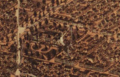
Seriously beautiful, especially the border sketches which to me a lot like historical Hong Kong (or probably any British colony of the era).
 U of T is basically part field, part park, save for Spadina Crescent (then Knox) and UC (then Provincial College, apparently). North-east of the big CAMH complex on the left is Trinity in its original site (now Trinity-Bellwoods). Vic was still in Coburg at the time; not sure where St. Mike’s was (yes, technically I’m an alumnus).
You can spot St. Stephen’s-in-the-Fields near the Spadina-College intersection; that’s the only part of Kensington I recognize. This was a couple of decades after the area was subdivided from an estate, but before it became home to waves of immigrants. And the Grange is further south, before it was split by Dundas I guess.
 South-east of that, is the palatial Osgoode Hall, at the foot of College Ave. The surrounding area is pretty much unrecognizable, and I think this was before it became Chinatown.
 South east of St. James (that biggest church on Church), you can see the North Market in its original form, and the (relatively) tiny thing across from it was the City Hall and jail.
This map is really worth checking out, but it is a 76mb JPG, so you may want to use a lab.
h/t: Fuck Yeah Toronto!
You can also see it in The Historical Atlas of Toronto, though it’s a bit harder to pick out details in a physical copy (this thing is serious huge). Also, the amazon link is for reference only – buy it at Book City or any other local bookstore if you can, because it’s kind of weird to celebrate this historical bookish dedication to the city then failing to support its contemporary form.
